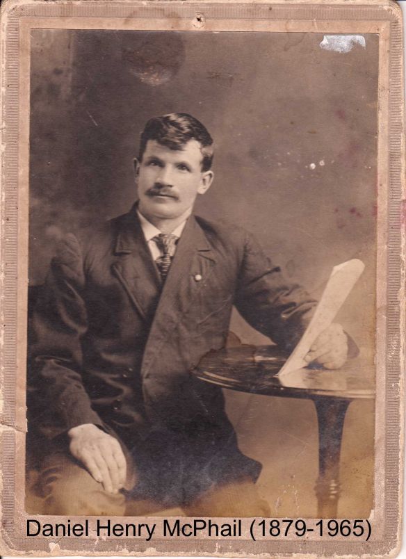
Daniel Henry McPhail
Settler of township lots: Lot 20, Conc. 6, Stanhope
Link to Settlers of Algonquin Highlands family tree
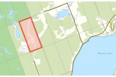
Location: Map point is the approximate location within this 97 acre lot running north from the north end of McPhail Road.
Land acquisition: 1910 from John Herbert Sisson. Ontario Land Parcel Register - Stanhope (Image 106).
Other lands:
- Lot 22, Conc. 6: 1930 from Mathias John Barry; 1931 to George Edgar Barry
- Lot 23, Conc. 6: 1933 from John McPhail (father)
Dates of residency:
- 1903 Stanhope Voters List: Daniel McPhail, farmer, Lot 20, Conc. 6
- 1911 Census of Canada, Stanhope: Daniel & Edith W McPhail (sister)
- 1901 Stanhope Voters List: Lot 20, Conc. 6
- 1911 Stanhope Voters List: Lots 20 & 22, Conc. 6.
- 1911 Stanhope Post Office List: Lot 6, Conc. 22. Delbert McPhail (brother) is listed at Lot 20, conc. 6.
- 1921 Census of Canada, Stanhope: Daniel McPhail living with mother Olive, sister Edith Fairfield and two adopted 6 year old boys Edward Sisson McPhail and John Sisson McPhail
- 1923 Stanhope Voters List: Lots 22 & 23, Conc. 6.
Interesting facts:
Preceding landowner:
- 1883 Henry Ferrier from The Crown
- 1885 Thomas Liddle
- 1910 Thomas Herbert Sisson
Succeeding landowner: 1916 Carmel Barry
Daniel Henry McPhail, photo courtesy of Norm Mark