Kushog Lake History
KUSHOG LAKE HISTORY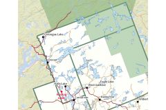
Location: Stanhope Township
Officially Named: by Geographic Board of Canada. 15th Report, gazette 1962
Kushog is Ojibwa, the "Indian name meaning 'long and narrow’ “ (MNR archives)
In 1860 Kushog Lake was called Kakwakshebemahgog on some maps and Kahshahgahwige-mog on the survey. This is Ojibwa meaning “that which doesn’t run straight, with a lot of narrows where you can see through or beyond.” The following year it appeared on maps as Cushog and Kushog – both spellings were used. The next year it appeared as Hall’s Lake. Probably Kushog is a corruption or slang version of these longer names.
It has had many other names over the years including Cushog, Koo-Shog and Kaskagawigamag. One early cottager called it Kushogabogawigamog.
The north basin (north of Ox Narrows) was considered a separate lake known as Kashagawi Lake, until the 1940s, and what is now called The Firehouse Restaurant was named Kashagawi Snack Bar when it was built by Johnny Broderick in 1950. (Source: Kushog Lake Property Owners Association website: https://kushoglake.org/origin-of-local-names.html)
Also Known As:
• Little Koshcawicamoc Lake (MNR archives)
• Little Coshogwigmog Lake (MNR archives)
• Cushog Lake (MNR archives)
• Smores Lake (MNR archives)
• Stretchers Lake (MNR archives)
• Kashagawi Lake (MNR archives), (map at Rudy's restaurant in Minden)
• Kashawigamog Lake (MNR archives)
• Kah-sbah-gah-wig-o-mog Lake (MNR archives)
• Kah-shah-gab-wig Lake (MNR archives)
• Hall lake (MNR archives)
• Hall's Lake (MNR archives)
• Kah-wah-sbe-be-mah-gog Lake (MNR archives)
• Kabsbabgahwige (MNR archives)
• Kasbog Lake (MNR archives
• Kasbagawigamog Lake (MNR archives), (Reynolds 1973, 99)
• Long Lake (MNR archives)
• Kosbogwigmog Lake (MNR archives)
• Big Coshogwigmog Lake "Indian word for Shoal" (MNR archives)
Note: KASHAGAWIGAMOG LAKE has been called Kushog Lake (MNR archives)
Unless otherwise referenced, the above information came from: Discovering the (Hi)story of Haliburton Through Its Lakes' Names by Elinor Whidden, a student report prepared for Trent University- Bioregionalism Course, 1998. From the U-Links Centre for Community-Based Research Collection.
Lake Association: Kushog Lake Property Owners Association Inc (KLPOA)
From the Kushog Lake Association:
In the field notes of the survey of our lake in 1860 by George A. Stewart, a provincial land surveyor, the lake was named Kahshah- gah-wig-e-mog. Another lake today has the same name. In an 1860 MNR report this lake was called Kakwakshebemahgog from Ojibway meaning ‘long and narrow.’ The following year (1861) it appeared on maps as Cushog, Kushug and in an 1862 map it was labeled Hall’s Lake.
Other names: Kashagawi in a report of 1912 and also on surveyors maps as late as 1952; Stretcher Lake and in 1870 it was Kashawig. Through the years other names were Kee shog and Kashagawiga.
In the early days of cottaging, the section of lake north of Ox Narrows was known as Kashagawi. The story is that following the road improvement work the signage was in poor shape and not very readable. As a result the new signs changed the name to Kushog. Another version of that story is that Hank Penrose, the owner of Ox Narrows Lodge at the time, had postcards made noting that the Lodge was on Kushog Lake. Those living on the lake at the time successfully applied to have the original Kashagawi name reinstated. But, Hank Penrose appealed the appeal and won, meaning that the name Kushog held firm.
First Nations People by Joyce Gibson, Kushog Lake Newsletter Spring 2009
Human occupation of Ontario began about 11,000 years ago; for the previous million years Ontario was covered by glacial ice. Eskimos and Indians migrated from Russia, across the Bering Strait to Alaska. Indians continued southward to Central and South America. It is difficult to get history about early First Nations people because they didn’t have a written language, although they had several verbal languages. They drew on rocks (petroglyths) birch bark and in the sand.
The first people to come to this region were the Iroquois, who came in search of furs around 1640. The Iroquois continued trapping in the area until around 1740 when other Indian bands of Algonkian descent, including the Chippewa (also known as Ojibwas) and Mississauga, drove them out. The Algonquin were a nomadic people, moving their wigwam villages by birch bark canoe to favoured seasonal locations. They lived lightly off the land, using the rivers and streams as their roads. They left few artifacts behind in their former campsites. There is no evidence of any camps on Kushog Lake. They only roamed, hunted, fished and gathered berries as they paddled along. No artifacts that we know of have been found around Kushog Lake.
The Mississauga cleared land for agriculture at Boshkung Narrows before 1851 – an Indian camp at Matabanick Inn on Boshkung Lake has produced many relics. There are native graves on the Howard Walker farm (which was originally pioneered by Joseph Pritchard) near Boshkung.
The First Nations aboriginal people generally left Haliburton after the first part of the nineteenth century and many settled in the Rama area near Orillia. On a visit to Rama, I met the great-grandson of Chief Bigwind (1843-1940) who was buried on Bigwin Island in Lake of Bays. Trading Bay at Dorset is so named because Chief Bigwind traded furs there. In 1900 Chief Bigwind sold the island to C.O. Shaw who built the famous resort on Bigwin Island.
Ontario Indian Reserves were established in 1834, and in 1923 the Government of Canada acquired three separate and substantial parcels of land in central and southern Ontario in what became known as the Williams Treaty. At the time of the signings, the land was being used by pioneers for settlement and other economic ventures in the lumber and mining industries. The Williams Treaty clarified all the treaties that had come before it.